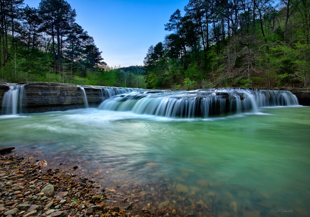
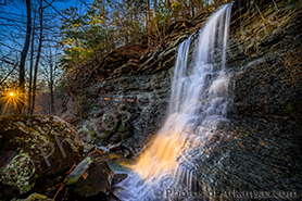
08/22/16 Featured Arkansas Landscape Photography–The washing machine on the Cossatot River Southwest Arkansas
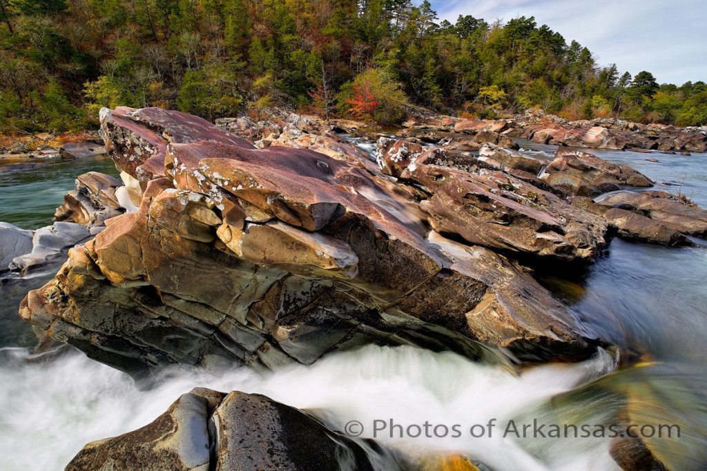
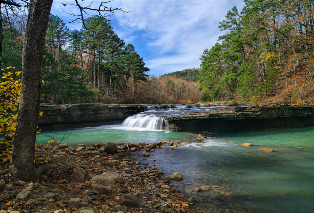
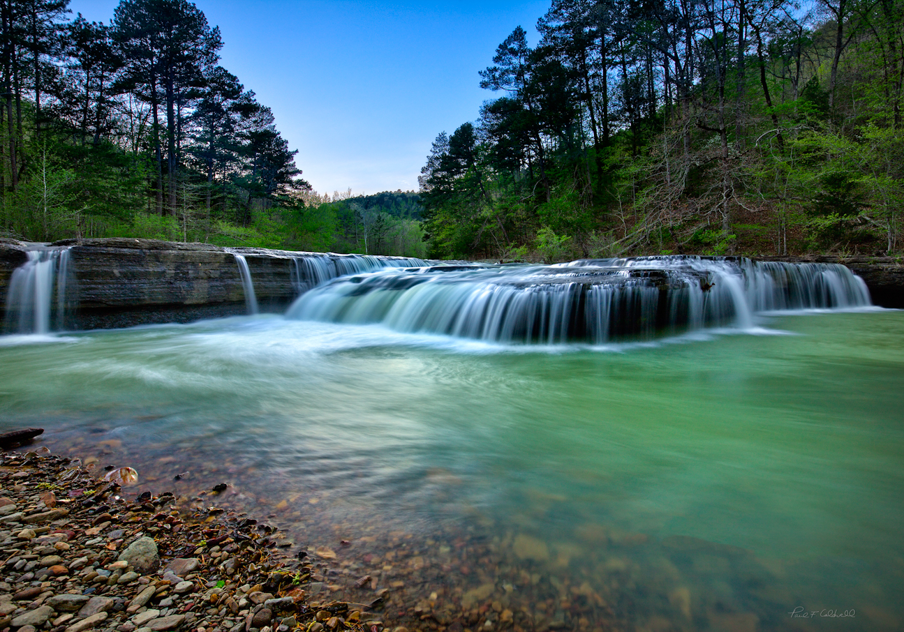
Taken with a Canon 5D MKII and 24mm TS-E lens, with a CL-PL and ND 0.9 filter installed, exposure time approximately 1.5 seconds.
You can find some excellent photographic opportunities on the Cossatot River, along with some of the best Arkansas whitewater. Go down there anytime the river is running over 500 cfs (cubic feet per second) and you can expect to see a lot of kayakers running the falls.
I like to hike the 6 falls when there is about 100 to 400 cfs max running the river. This allows you to make easy crossings and you can still get down close enough to the river to get some great angles. The river will run muddy right after a rain storm due to the massive amount of timber clear cutting in the area, so plan on heading down a day or so after a big rain.
You can easily hike down the entire left side (left side facing downstream) and there are 6 separate ledges which the river cuts through. Each has a unique rapid and name:
Cossatosser, Eyeopener, BMF, The Washing Machine, Whiplash, and Shoulder bone.
If you make it down there, remember that the sun will move across the river from left to right so the some of the best photograph will be early in the morning. The falls run due south. There are a ton of huge rocks that line the river and each of them will allow you a spot to setup for some great photos. The washing machine, featured in this photo has some of the best angles up on top of the ledge, but you need to cross over right above this small rapid. If the river is running too high, this can easily become a hazard so be careful. All the rocks are covered with slim moss and will be slick.
The rock is sandstone or something close and in the sun will take on a wonderful red-orange hue so try to make it on nice sunny day.
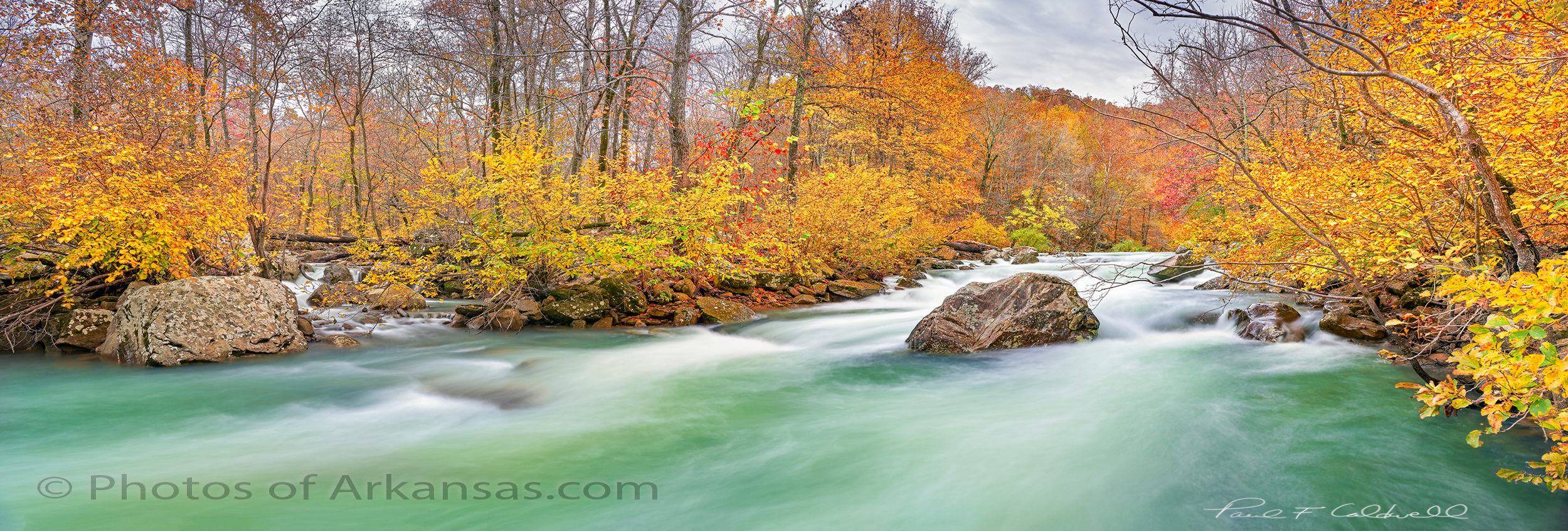
12/18/15 Featured Arkansas Landscape Photography–Late afternoon on Richland Creek
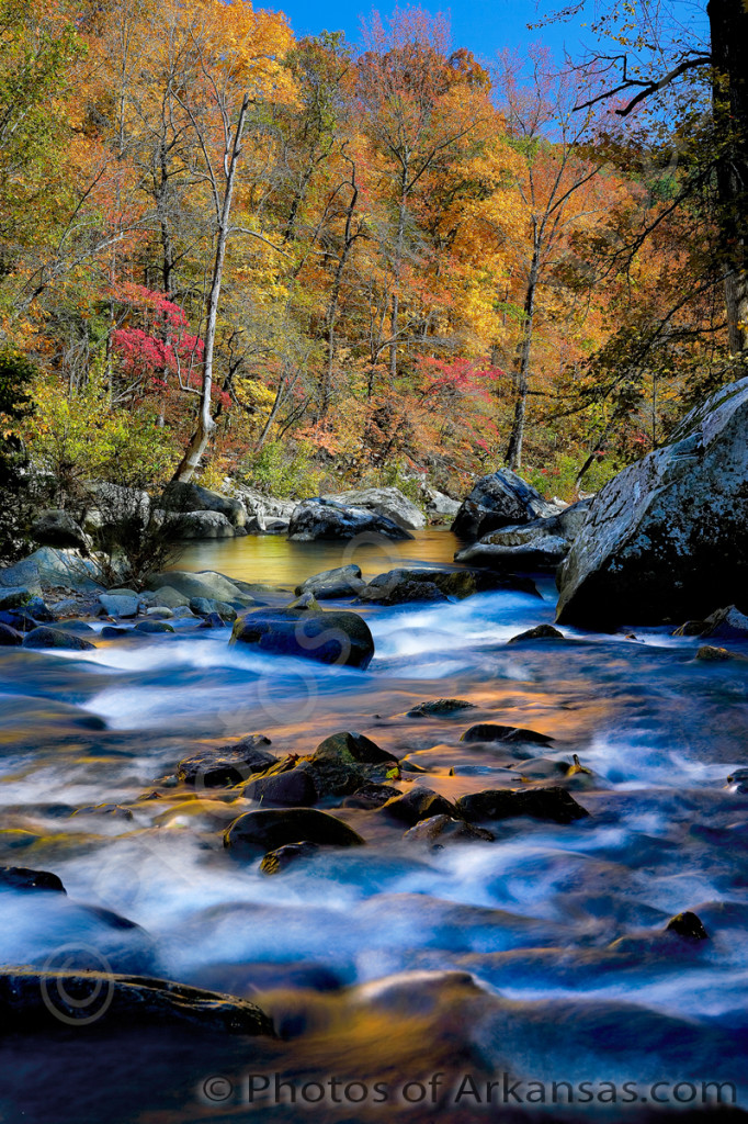
Taken with a Canon 1ds MKII, 24-70 Lens, @ 24mm, with a CL-PL and ND 1.2 filter, ISO 100 for 2 seconds foreground and 1/250 background.
What can I say about Richland Creek, it’s one of the rare gems in Arkansas. The Richland Creek wilderness was established in the 1970’s and has a huge outdoor appeal. The creek offers fishing, hiking, kayaking and of course photography. I have been hiking up Richland for the past 25 years and hope I can make a few more trips before my knees give out. I have probably shed more blood and gear on this creek, having taken several bad falls and breaking at least 4 cameras or lenses over years. But to me it’s worth it.
Richland is the 3rd or 4th largest tributary of the Buffalo and comes into the Buffalo at Woolum Ford. It’s headwaters are about 25 miles due west from Woolum. The best parts of Richland are the 6 miles from Moore to the Richland Creek Campground and the following 10 miles downstream to the low water bridge. The creek is very isolated and you can expect to cross it several times on your hike upstream. Going upstream from the campground, look for a trail on the left side of the creek. Since Richland is in Wilderness, the Forest Service will not make a permanent trail (STUPID), BUT THAT’S THE GOVERNMENT. You can find the make shift trail on the left bank pretty quickly as most of the time it stays within sight of the creek. From the campground up to the big bend where Big Devils Creek comes in, you will find over 20 major rapids most of which have a name.
You can hike Richland anytime of the year, but make sure the water level is running about 400 CFS (cubic feet per second) or less. Anymore than this and you can have a lot of trouble crossing the creek. Be careful when crossing as the creek bottom is mainly limestone and slick. The hike from the campground to Richland Falls is about 2.0 miles but plan to spend extra time along the creek. There are not many other places in Arkansas where such a beautiful creek runs by house sized boulders.
PLEASE NOTE: All of the photography of this website is the property of www.photosofarkansas.com and is copy right protected. Do not copy any of the images on this site to paste on Facebook, Pintrest, or any other website without the permission of Paul Caldwell. Years of time have gone into capturing these photographs, please respect that. I do not take copy right infringement lightly. If you have a need to display any of my work on your site ASK me before you Copy & Paste.
11/12/15 Featured Arkansas Landscape Photography–Haw Creek falls in Autumn
Taken with a Canon 1ds MkI, and and Canon 24-70 lens, iso 200.
I had to dig back a few years to find this, as it goes back to 2004, but since Arkansas had such a terrible fall in 2015 I have found myself doing this a lot lately. Haw Creek has some wonderful fall color displays but catching the falls with water in them and fall colors is one of the harder things to do. On the afternoon I caught this shot, I have been driving around looking for late fall color, stopping at both Falling Water Falls, and Richland Creek, but neither of them had much water. For some reason the rain that fell the night before did hit the Haw Creek drainage harder and the falls were running. I almost did not make the driver over from Lurton on Hwy 7, but was glad I did.
I was able to setup and get this shot before the sun moved over to the lower left of the frame. As it was the sun was perfect hitting on both the falls and the pool below. Note the green color, which is common to all Arkansas Ozark streams, but seems to be more prominent in the fall and winter. I have always assumed it’s due to the limestone content in the water.
I shot this photograph in 3 separate segments as I was wanting to get more overall resolution. The older Canon 1ds MKI only had 11MP and that’s just not enough for a large print. Now that Lightroom has added a stitching solution, I am going back to a lot my older Canon work, either from the 1ds or 1ds MKII as both cameras captured great color, but I was using either a totally manual stitching method or a Zork adapter. Using Lightroom’s new solution makes for a much faster stitching process and you are left with a dng file. This allows you still use Lightroom’s excellent tools on the image as if it was a raw file.
This year, the colors were terrible at Haw Creek, mainly brown. The water level was actually pretty good for a few day’s and I ran into a few photographers up there, but I didn’t even get my camera out. The trees just didn’t have any life to them.
01/24/14 Featured Arkansas Photography–Wintertime on Richland Creek featuring Shaw’s Folly Rapid
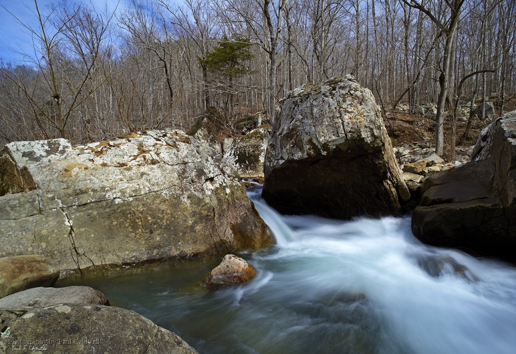
Taken in 2007 with a Canon 1ds MKII, Zork Adapter with Mamiya 35mm lens, F11, ISO 100, for 1.5 seconds. Richland creek is one of the most scenic spots in Arkansas, offering hiking, kayaking, and camping opportunities. The creek is one of the major tributaries of the Buffalo National River and has good flow most of the year. By far the best parts of the creek to hike are the upper reaches. Here you have have approximately 6 miles of creek and about 5 miles are just studded with great photographic opportunities. If you work the creek in the wintertime be aware that the water temperature will be around 41 to 45 degrees F. Dress warmly and look for safe places to cross. Richland has a strong flow throughout and it will fool you quickly on a crossing. During the winter you can often find great ice formations either in the creek or along the bank and many of the waterfalls that come along the creek will be frozen. It’s an easy place to look for a unique photographic study, just find one of the spots like the one in the photograph and setup. Richland is loaded with spots where house sized rocks have fallen off the surrounding bluffs or have been moved downstream during epic flooding. Enjoy!
11/01/13 Featured Arkansas Photography–A sign that nature will always win
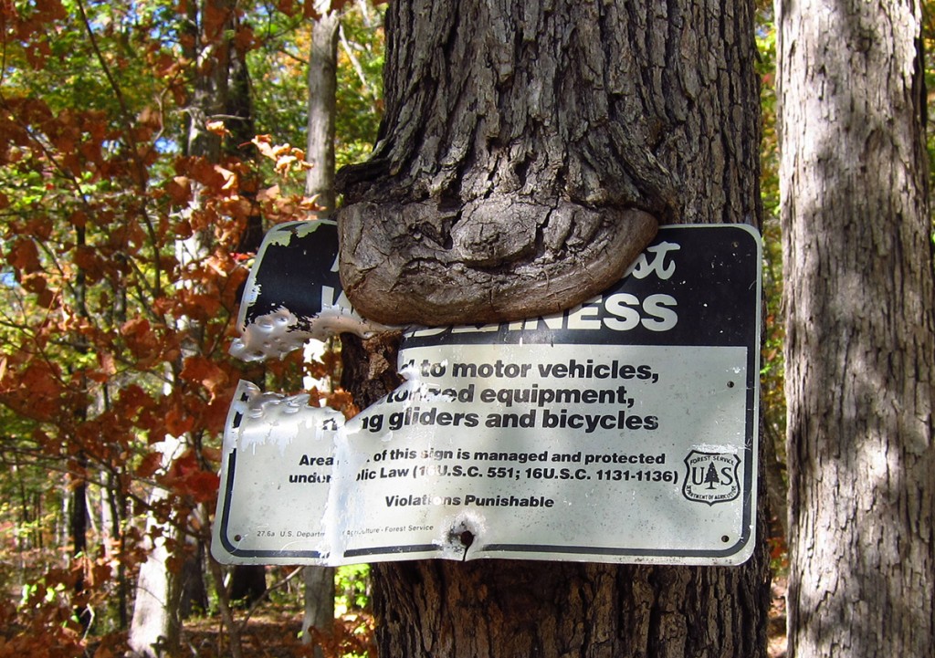
Taken with a Canon S95, iso 200. After a long hike along Richland, I came across this sign near my truck. I stopped for a minute to take a few photographs of it since it showed in just image what’s going to happen eventually to anything man made, i.e. nature will always win. Here you have a wilderness boundary marking sign that has been almost eaten by a tree. This I am sure took many years and was helped along by the Stupid Redneck or many Rednecks that decided it would be a neat idea to shoot a “helpless” sign. Note the entire left side is gone from what looks like a shotgun blast. This always amazes me as this sign is near a trail head and you never know who might be coming up the trail. However even taking the man made destruction, I found that fact the tree was starting to eat the sign and in about another 15 years, more than likely the sign will be gone, the tree should still be there. Sadly Arkansas did not receive anywhere enough rain to bring up Richland during the this fall so I tried for some other spots. Richland is definitely a magic spot and one of favorite spots to photograph in the U.S. not to mention Arkansas.
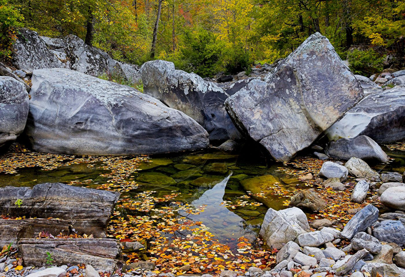
08/23/13 Featured Arkansas Photography–Rocks and Leaves on the Cossatot River
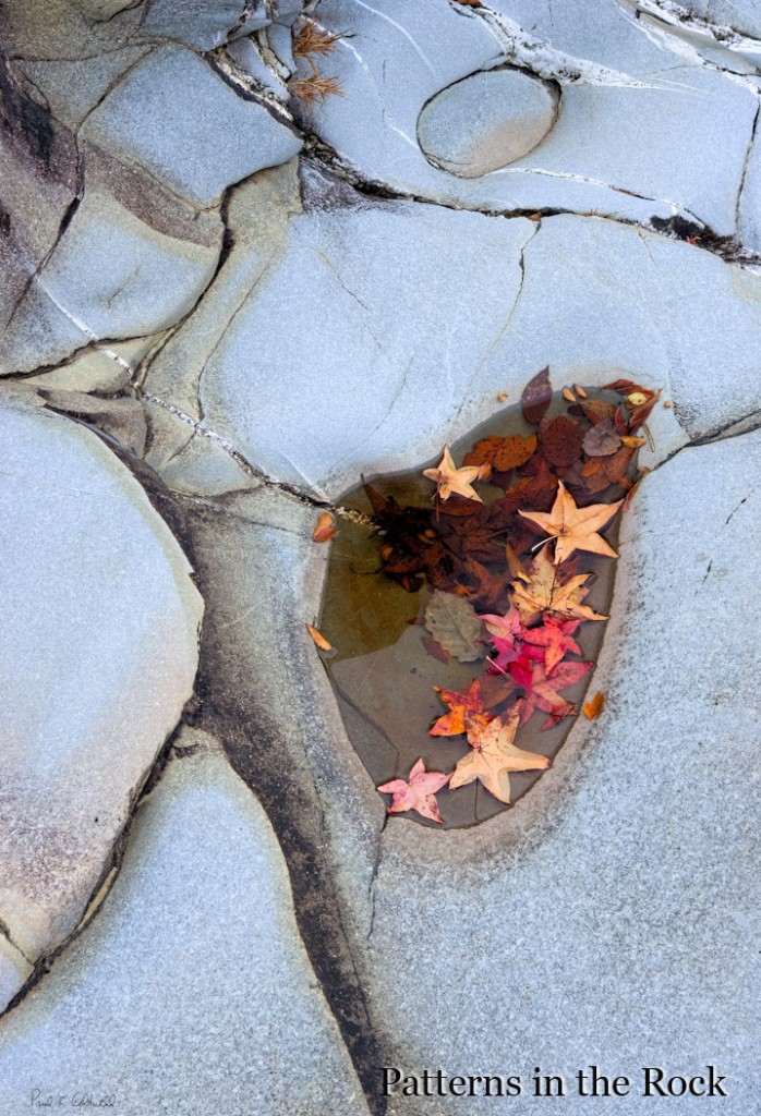
Taken with a Canon 1ds MKII, iso 200, Canon 24-70 Lens @70mm, 1/60th of a second. The Cossatot River is one of my favorite spots to hike. You have all sorts of photographic subject matter to work with. The Cossatot River is in the southwestern corner of Arkansas Ouachita Mountains. You can find some of the best photography in the area known as the 6 falls or Cossatot Falls. Here the river turns due south and drops over 6 separate ledges, each of which have unique rapids and names. The rocks around Cossatot Falls are sandstone and have been worn totally smooth by the action of the water. You can find all types of interesting formations, such as the one in the photograph above where lines of quartz are running through the rocks.
07/08/12 Featured Arkansas Photography–Haw Creek Falls in Better days (before the drought of 2012)
- At July 08, 2012
- By paul
- In Featured Arkansas Photography
 0
0
Taken with a Canon 5d MKII, Canon 16-35mm lens @ 16mm, iso 100, taken in 5 exposures ranging from 1/5th to 5 seconds. Haw Creek will always be one of my favorite spots in Arkansas. I try to go there many times during the year. I spent 3 nights there in late March and early April in 2012 working the night skies. It’s a great spot for this as you can get a waterfall and not have to walk too far into the woods. Of course you always have to work around the usual Arkansas locals and their flashlights and cigarettes. As the night wears on most of them will leave or pass out. The best times to work Haw Creek are during the week nights as the number of people will be much less. The campground at Haw Creek is open through the fall and is one of Arkansas’s best small campgrounds. NO HOOKUPS for those who prefer to bring along the house, but you can still drive your RV’s into the campground. Note, if there is a locally heavy rain, be prepared to wait out the creek. I would not attempt to cross Haw Creek if you can’t see the metal posts that the forest service has by the concrete slab. These are about 18 inches tall and if you can’t see them then the water in the center of the crossing will be over 24 inches deep!. Enjoy this spot. However right now it’s dry as a bone as are all the creeks in Arkansas right now as we endure one of the worst droughts in recent history.
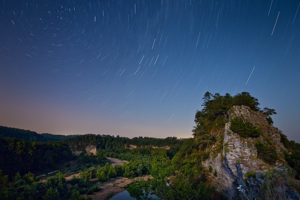
07/05/12 Featured Arkansas Photography–Night skies over the Narrows on the Buffalo River
- At July 05, 2012
- By paul
- In Featured Arkansas Photography
 0
0
Taken with a Canon 5D MKII, Canon 14mm lens, iso 250, F 5.3, for 35 minutes. Not the easiest place to get to now, due to the flooding that occurred in 2010. The Narrows is a unique part of geography in Arkansas. On one side you have the Buffalo River and off in the distance, Richland Creek. Richland runs into the Buffalo not far from here, but way back hundreds or thousands of years ago, Richland ran right up along the other side of the Narrows and the two streams almost met!. The ledge is only about 2 feet wide in places and it’s quite place to walk. The view downstream featured Skull bluff and then around the bend is Woolum Ford. Be careful if you try to get to the narrows or “nars” as the locals call it by crossing the Buffalo at Woolum ford. The actual ford has changed quite a bit over the past few years and is deeper and a bit tricky at most water levels. Due to the excessive drought Arkansas has going right now, it may dry. Once you cross the ford be VERY CAREFUL IN THE SAND. This is great place to get stuck!. The best way is to use 4 wheel drive and go straight up the hillside and cut across the field, don’t try to stay in the ruts as they are now full of sand and very tricky. Even with four wheel drive.
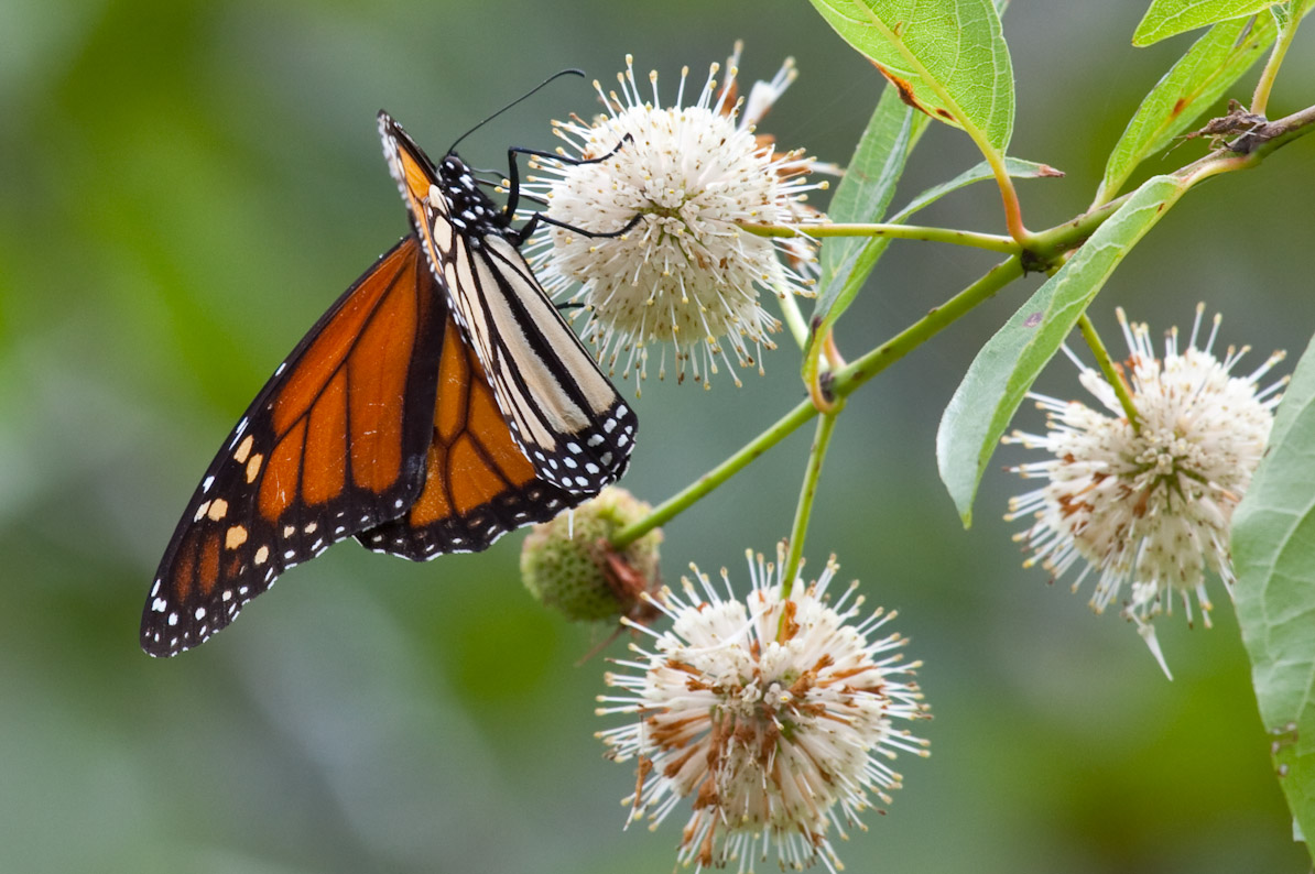
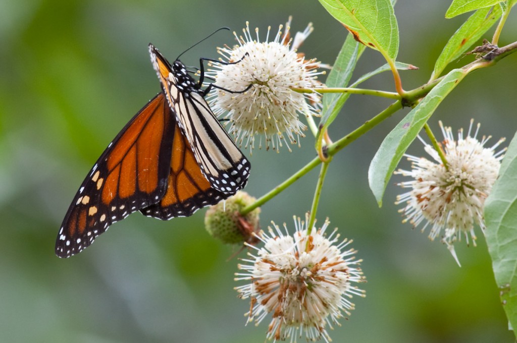
Read More»07/02/12 Featured Arkansas Photography–Monarch in the Boxley Valley
- At July 02, 2012
- By paul
- In Featured Arkansas Photography
 0
0
Taken with a Canon 5D MKII, 100-400 Zoom lens @ 300mm, F11, iso 100, with image stabilization. On this day I was up in the Boxley valley to photograph the 5 tame swans that tend to populate the old mill pond. For some reason on this day the swans were nowhere to be found, but as I was walking around in the scrub bushes, I found a group of Monarch butterflies that were working a plant at the edge of the pond. I still don’t know what this plant is, but they were all over it. In fact they were so interested in the plant, that they let me get within 4 feet of them before spooking. I spent over an hour photographing them and most of the wait was on good light. That day the sun kept going behind the clouds.

