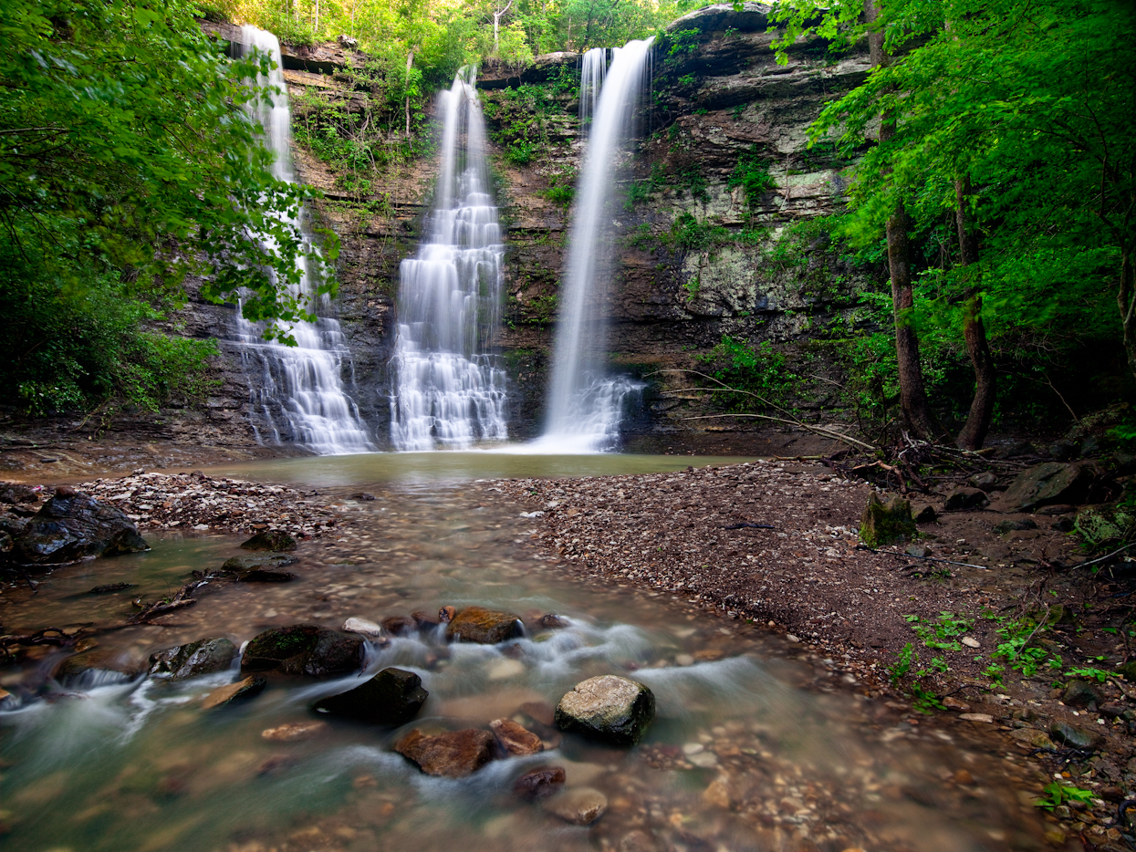
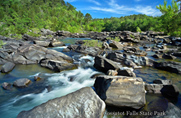
09/07/12 Featured Arkansas Photography–Twin Falls of Big and Long Devils Forks in the Richland Wilderness
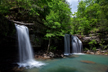

Twin Falls on Big and Long Devils Creek in Newton County Arkansas
Taken with a Canon 5D MKII, Canon 16-35mm Lens at 16mm, F14, approx 1 sec exposure, iso 100. One of the best spots in Arkansas to photograph waterfalls is the Richland Creek Wilderness Area. You have unlimited waterfalls to look for in a hike up Richland Creek on a good water day. You will need at least 100 cfs (cubic feet per second) of flow in Richland to get a good shot of the Twin Falls. You can best reach Twin Falls by hiking up Richland Creek from the campground on Forest Road 1205. It is about 1 mile but it’s a long mile with lots of up and arounds as there are many dead trees in the way. If you start the hike from Richland Campground, make sure you stay on the left side of Richland all the way to the big bend where Devils Creek enters into Richland. There is a pretty easy trail to follow for most of the way and now that the campground is open again, more people will be hiking up to the falls. If you are a photographer, I would recommend hiking to the falls during the week as there tends to be many more folks up there on the weekends and it’s not an area that can easily accommodate many people. WATCH OUT FOR HORSEMEN AND WOMEN as they now are coming down to Richland falls and coming over to Twin falls. It’s not an easy spot to negotiate with a horse so be careful. On a good water day say over 400 cfs you might be able to catch kayakers coming down upper Richland.
The best water conditions for hiking and photographing Richland are between 50 and 400 cfs. Anything lower and most of the creek’s features will not be formed well and if it’s higher than 400, then you have some tough crossings to make. Richland is no slouch and it’s not very forgiving to fools. Be aware that the bottom is slick and the current is strong. If you start to cross and don’t have a good grip on the bottom, then more than likely you will be swimming. I also recommend that you use a pack that is totally waterproof like the ones from Lowe Pro. The ones that have a waterproof inner back that closes with a heavy duty waterproof zipper. When I hike Richland low, I will most often use a pair of wading boots that have felt soles as these give you much better traction. The other thing to consider is when the water is high and moving, more than likely you will not be able to view the bottom so it’s best to place your feet one at a time as it’s easy to get tripped up on a rock or two.
Richland is a fascinating watershed. It’s seems to come up faster than the nearby Buffalo River and also often hold more water longer. The Buffalo has a much large watershed but still Richland more times than not will be higher after a good rain. You can easily gauge Richland and most of the large creeks in Arkansas by going to the main USGS water website and then select Arkansas and then drill down to Richland. The actual gauge on Richland is at the campground bridge. Richland is pool drop which means that is does not have a continuous flow unless it’s over around 4500 cfs (that’s a lot of water). The area around Richland is a great hike in the spring, winter and fall. Most times in the summer (like this one in 2012) Richland will dry up or be running with less that 10 cfs. In the fall if there is good water over 30 cfs, make a trip up to Richland as it has one of the best fall color displays in Arkansas.
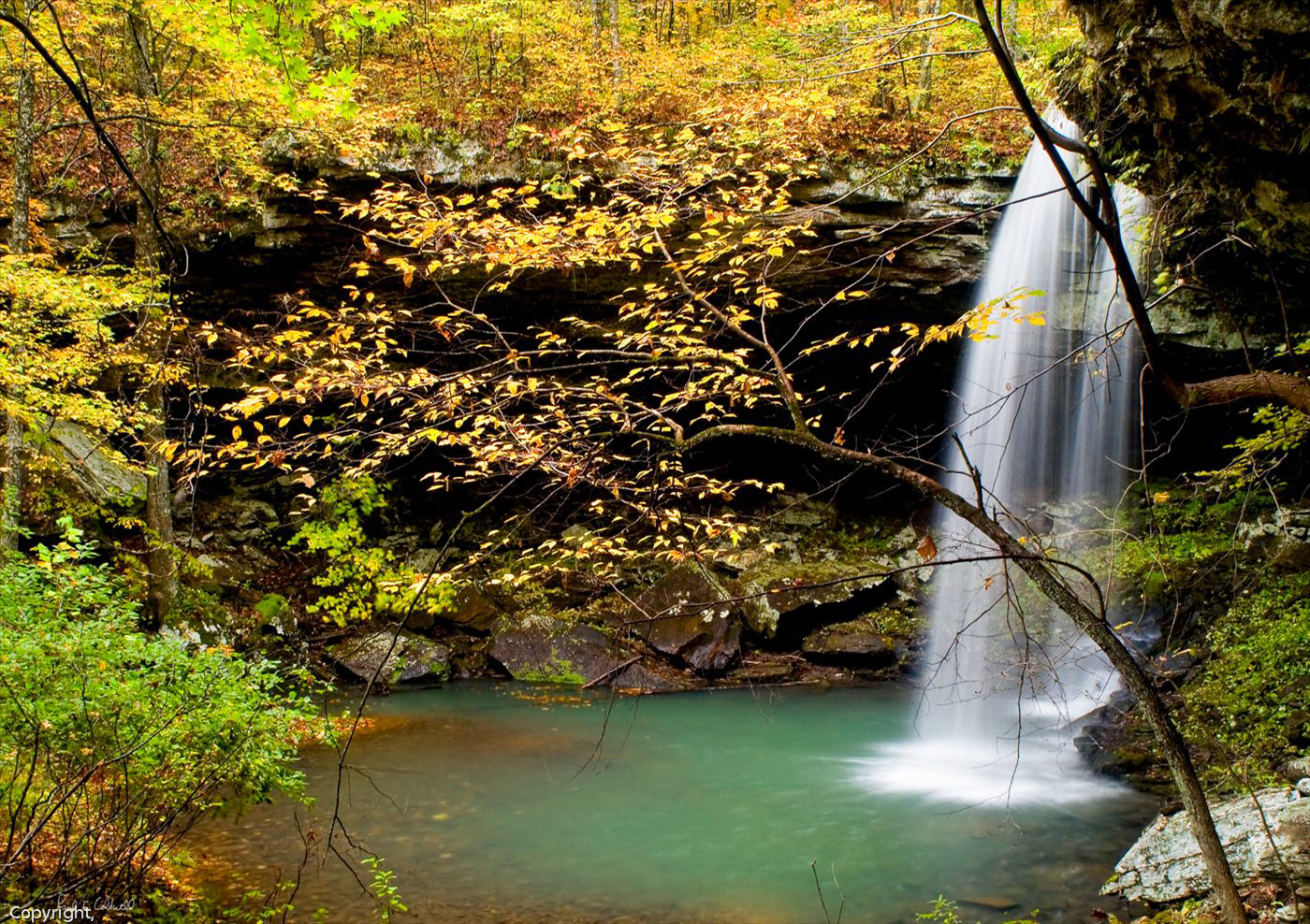
09/02/12 Featured Arkansas Photography–Cedar Creek on Petit Jean Mountain

Cedar Creek Below the falls on Petit Jean Mountain
Taken with a Phase One P45+, Mamiya 35mm F3.5 lens @ F14 for 2.5 seconds. When hiking along Cedar Creek one must always consider the views of the creek below Cedar Falls. I like to call this area the rock fall as so many large rocks have fallen down from the area bluffs. The best time to photograph here is after a good rain which will give you the best water features. When shooting water like this, I will always use a slower shutter speed, in the 1 to 5 second range. To accomplish this I use a circular polarizer and a neutral density filter. The ND filter allows me to reduce the amount of light coming into the camera to allow for the longer shutter speeds. The main issue you will tend to have here is the blur caused by wind. To compensate for that, consider taking a shorter exposure at around 1/60 of a second. This will help to stop the leaves and reduce the blur. Later in post, combine the two images. You may have to remove your ND filter to gain a fast enough shutter speed. Petit Jean is about a 45 minute drive from Little Rock and is great place to go and spend a day exploring.
08/28/12 Featured Arkansas Photography–Nighttime stars over the Big Dam Bridge in Little Rock Arkansas

Nighttime stars over the Big Dam Bridge in Little Rock Arkansas
Taken with a Canon 5D MKII, 14mm Lens, F4, approx 20 seconds, iso 400. I don’t spend too much time down at the big dam bridge, but it can be an interesting night shot on a clear cool night. On this night, it was pretty warm, over 85 degrees so I picked up some rose streaking in the sky. However the stars themselves stand out very well. I picked a night when they were running a bit of water through the dam so the 20 second exposure was plenty to blur out and smooth the water. The lights on the top of the dam took on a nice starlight look due to the 14mm lens. I recently sold the 14mm Canon since I am in the process of moving to Nikon, but I will miss that particular lens.
The Big Dam Bridge runs across the Terry Lock and Dam and allows cyclists, walkers and runners to cross over the Arkansas River to the North Little Rock Side of the bridge. I took the shot from the North Little Rock side, looking back towards Little Rock.
If you look closely over the middle of the bridge, you can easily spot the constellation Orion. The belt is very easy to see. I also liked the way the rose colored sky blended in near the tops of the hillsides.
08/22/12 Featured Arkansas Photography–Dry Creek Falls Autumntime
Dry Creek Falls in Fall in better days
Taken with a Nikon D1x, (man that’s old!!), Nikon 28-70 lens, F14, approx 8 second expoure, iso 200. This is an old one, but a good one, a great view of what Dry Creek Falls used to look like. The falls are about 20 feet tall and are at the ground level. You walk up on the falls as a ledge drop and they are often missed by hikers. I used to make 2 trips per year to these falls, but now the area is ruined. Arkansas had a terrible ice storm in 2009 that caused a tremendous amount of damage to the trees in both Search and Newton County. Mainly what happened is that the tops of the trees were loaded up with ice and then with high winds the tops broke off. Around the Dry Creek area, it also appears that a very powerful storm also came through as there are a huge number of downed trees in the area.
The terrain around Dry Creek Falls was especially hammered by the ice storm and wind/thunder storms. This view that is featured in the photo, is no longer really that good anymore. Several large trees have dropped over the ledge and now hang down from the top and ruin the view of the falls. The area below the falls is still full of dead trees and looks like a lumber raft. Some of this will eventually wash downstream with high water, but when you hike above the falls you see a ton of fallen trees that will also wash over the edge. Many of the trees that added to the overall shot have either broken off totally or worse are broken over and now the dead, broken tops hang down into the shot. It would take a good team with a a chain saw and a team of mules to really clean out the area.
When you walk into the Dry Creek falls area, you now have to take a large numbers of detours around the fallen trees that now block the road. Just back to before 2009, you could walk to the falls in less than 30 minutes in a pretty straight forward hike, now it takes about 3 times as long and it’s very easy to loose the trail on the way. Plus when you arrive, you are totally disappointed by what has happened to the falls. On the top of the ledge where there used to be huge trees, now there are big craters where these same trees fell over pulling the root balls with them. Also on the far side of the ledge, there was a pretty big land slide that included many large trees, and this makes just getting around the ledge to the falls much harder.
I have many shots taken over the years to remember this area by, but it did make me sad to see the condition it’s in now.
08/13/12 Featured Arkansas Photography–Fall Scene on the Cossatot River
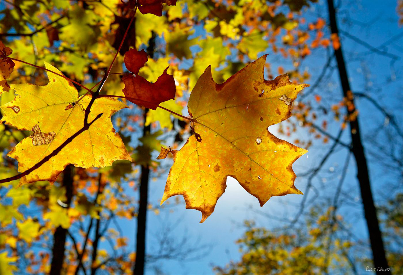
Maple leaf in the sun, Cossatot River area Ouachita Mountains Arkansas
Taken with a Canon 1ds MKII, Canon 24-70 lens @ 70mm and F 14, iso 100, Shutter speed 1/160 of a sec. With the fall season just about here, actually in many places it’s already here in Arkansas as a lot of the trees have turned brown due to the excessive drought. This shot was taken during one of my many hikes along the Cossatot River in the southwestern Ouachita mountains. The Cossatot is a great stream, just takes a while to get there from Little Rock. When the levels are right, the Cossatot is one of the best kayaking spots in Arkansas. The area known as Cossatot Falls is the real mecca. Here you can find 6 distinct rapids each of which has a unique name. Along the banks of the Cossatot you can find wonderful displays of maples, oaks, and gum trees. I found this shot on my hike back out as the sun was starting to set and I was able to position the sun so that it back lit the leaf just the way I wanted. I used a polarizer to help block out unnecessary reflections and to give the sky a deeper blue hue. Fall is definitely one my favorite times to photograph Arkansas.
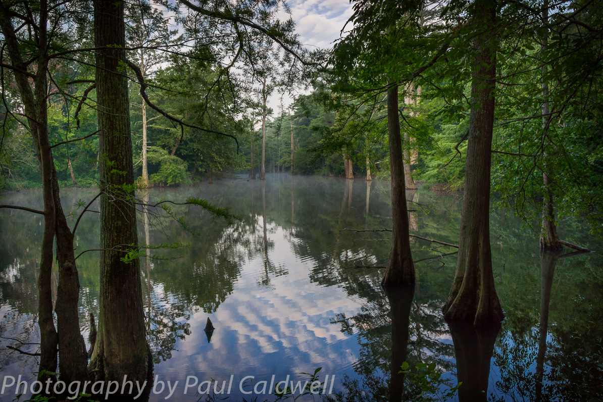
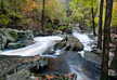
08/09/12 Featured Arkansas Photography–Richland Creek Reflections
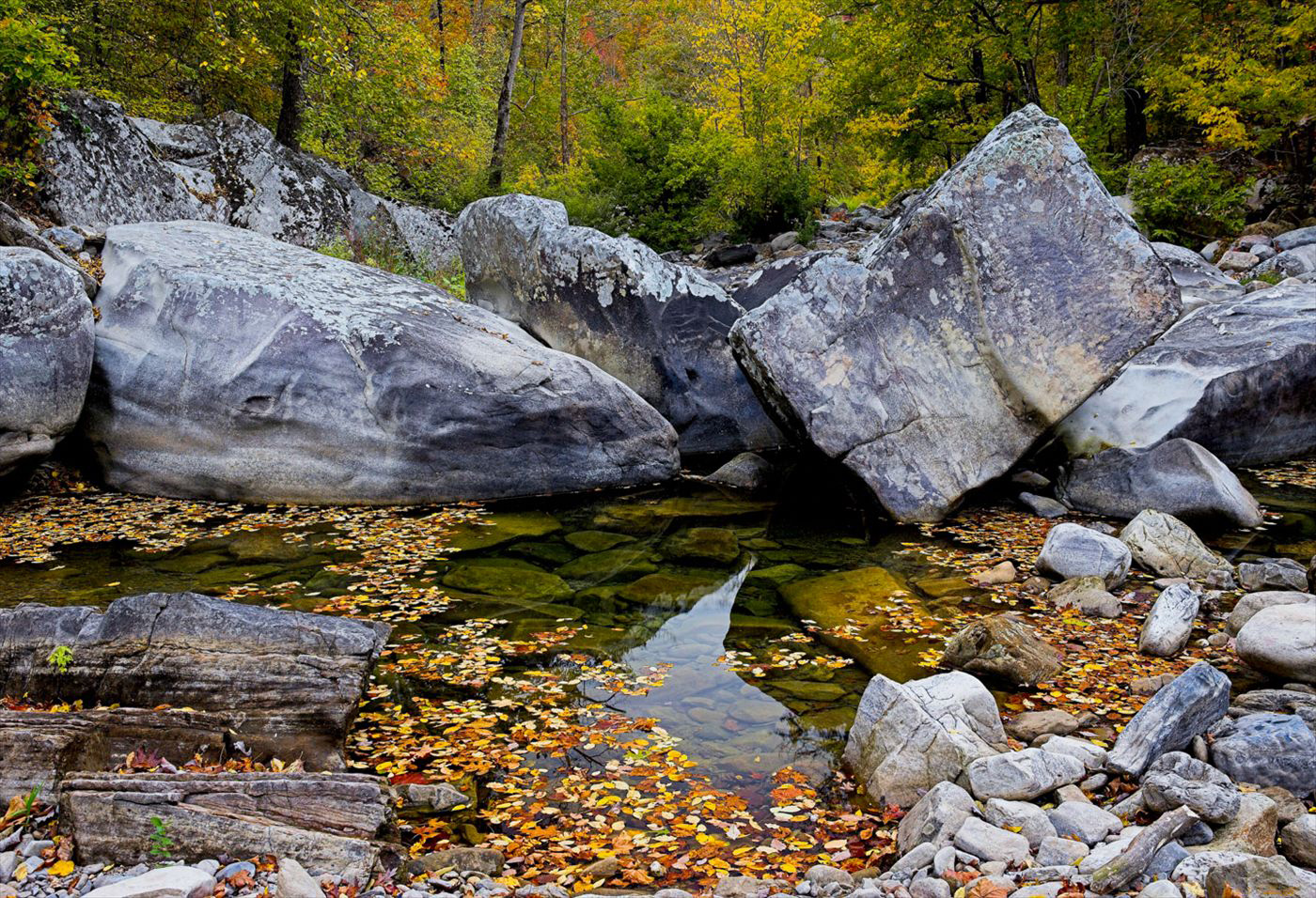
Cloudy Day on Richland Creek, Newton County Arkansas
Taken with a Canon 1ds MKII, Single Exposure with a Canon 24-70 Lens @ 35mm, F11, iso 200. This is better than Richland Creek will look in the the for 2012 unless Arkansas starts to get a lot more rain. Currently the creek is dry for almost it’s entire length. There might still be a bit of water in the deeper pools along the lower creek below the campground bridge. However I doubt that most of the pools above the bridge have any water left in them. The USGS guage has not reported any level for Richland for about a month now, so I feel that the large pool at the campground bridge is dry also.
On a cloudy day you have a much harder situation to work with since your sky will attempt to go white or light gray. Personally for my work I don’t prefer to see the white sky effect and since I don’t tend to combine images, i.e. take the sky from one and the scene from another, when shooting a scene like this most times I will move in closer and take the sky out of the frame. On this day the light was very neutral, no visible highlights and the shadows were all pretty even. I still liked the visible color on the creek so I walked up looking for a scene that might work. This group of rocks is called Cindy’s Hole Rapid and is quite a fun drop when there is a bit more water in the creek. I like the way the rocks work all the way across the creek and have such distinctive shapes. Richland creek is a great day hike for any photographer looking for the beauty of Arkansas’s outdoors.
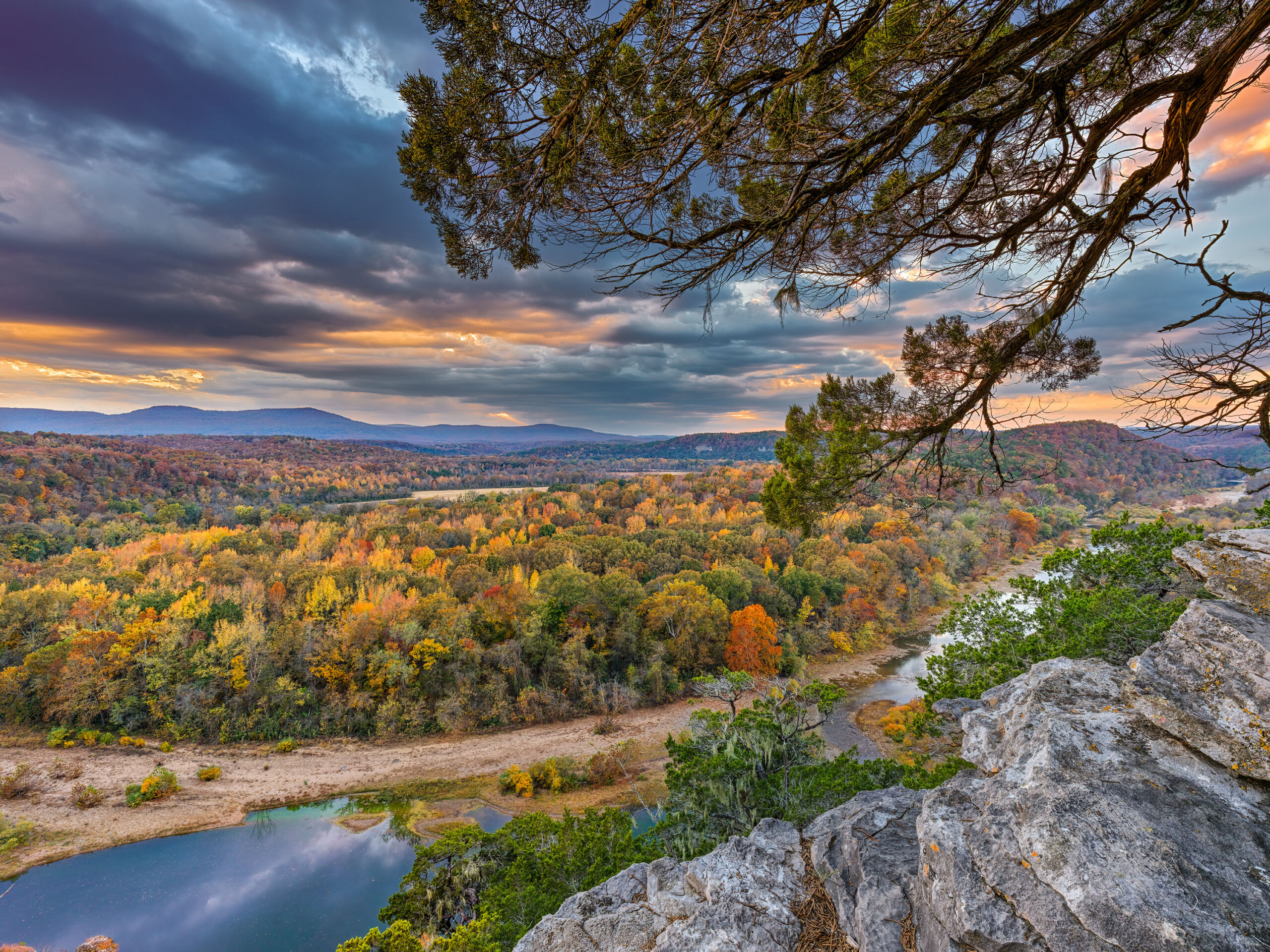
08/05/12 Featured Arkansas Photography–Early morning view of Red Rock and the Middle Buffalo River Valley
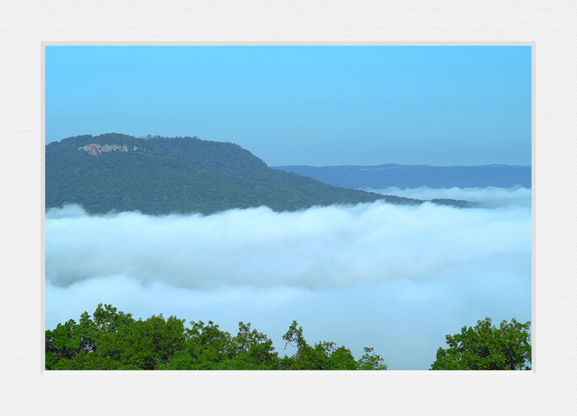

A view of Red Rock and a foggy morning in the Middle Buffalo River Valley
Taken with a Fuji S2, iso 200, Nikkor 85mm 1.8 @ F 5.6, 1/60th of a sec exposure.
While on a road trip across the Ozark mountains near Mt Judea Arkansas, I came around a corner in the road and saw this view. The entire valley of the Buffalo River was swathed in fog and only the top of Red Rock was sticking out. Red Rock was at one time one of the most popular rock climbing spots in Arkansas. Recently due to private land issues and the fact that newer more challenging areas have opened up the climbing craze has passed Red Rock by. You can still get very close to the base of the formation or view easily from a distance. It stands out over the valley of Vendor and Hwy 374 courses right along the base. I know longer know if there is a road open to the summit, but if you can find one the view would be most impressive!
A view of Red Rock and a foggy morning in the Middle Buffalo River Valley
A matted view of the same image.
08/03/12 Featured Arkansas Photography–Sunset from Flatside Pinnacle
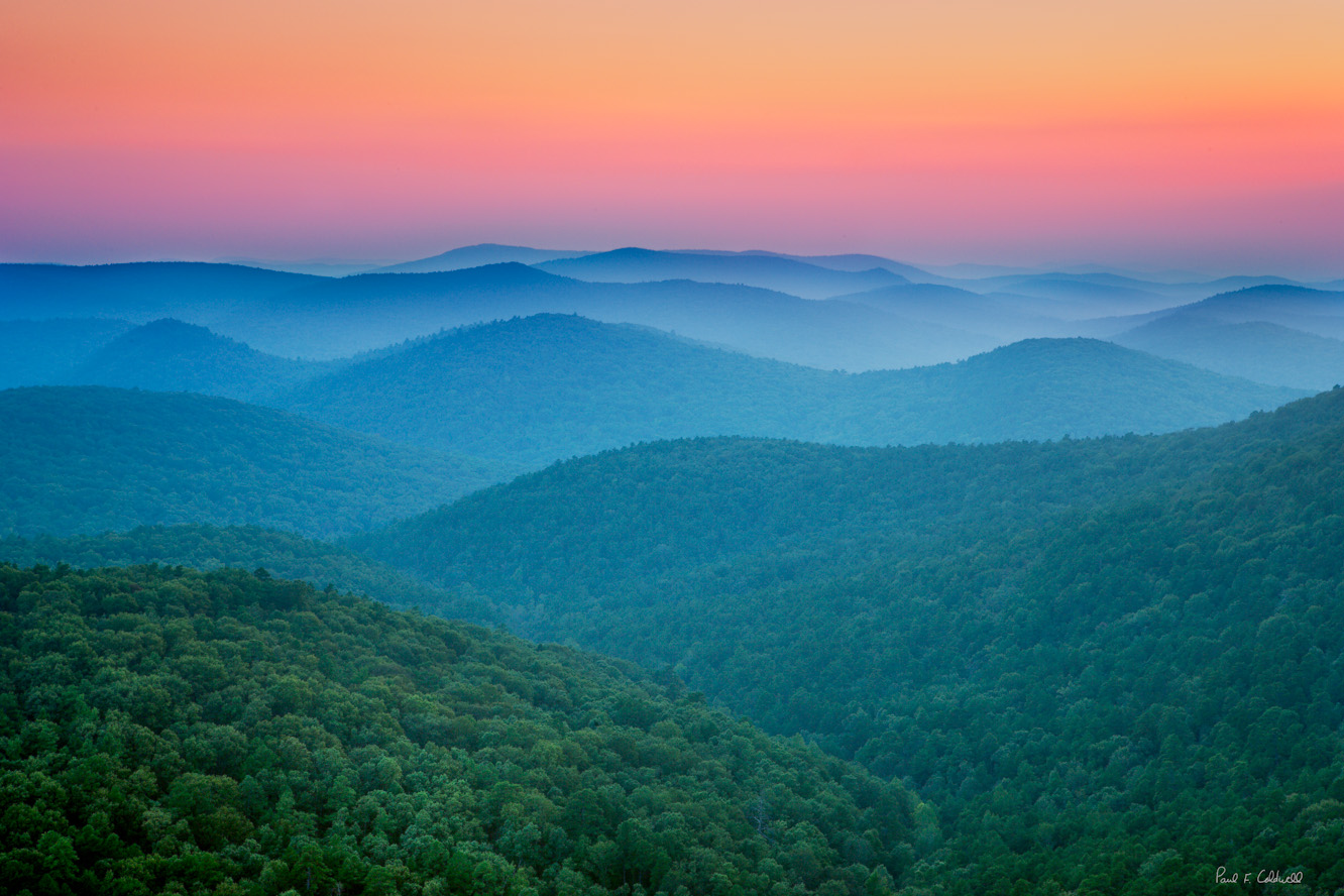
Sunset from Flatside Pinnacle looking to the west and Forked Mountain
Taken with a Canon 1ds MKII, iso 100, HDR series 5 frames, Canon 24-70 lens @ F11. Flatside Pinnacle is one of those places that once you make a trip there, you will find yourself going back many times. You can catch a great sunset looking out over the Ouachita mountains, or if you are there early in the morning, the fog will be down in the hills. Flatside is an easy 40 minute drive from Little Rock, west on Hwy 10 towards Lake Sylvia. I took this shot with a Canon 1ds, MKII, in a 5 frame HDR series. The sun had already set and the exposure times were from around 5″ to 20″. The effect I was after was the light playing off the haze in the distance. The colors of the sky that day were amazing. The hike to Flatside will take you near the 150 mile Quachita trail which runs east/west across most of the Arkansas Ouachita mountains and into Oklahoma.
07/30/12 Featured Arkansas Photography–How much is that Kitty in the Window?
- At July 30, 2012
- By paul
- In Featured Arkansas Photography
 0
0
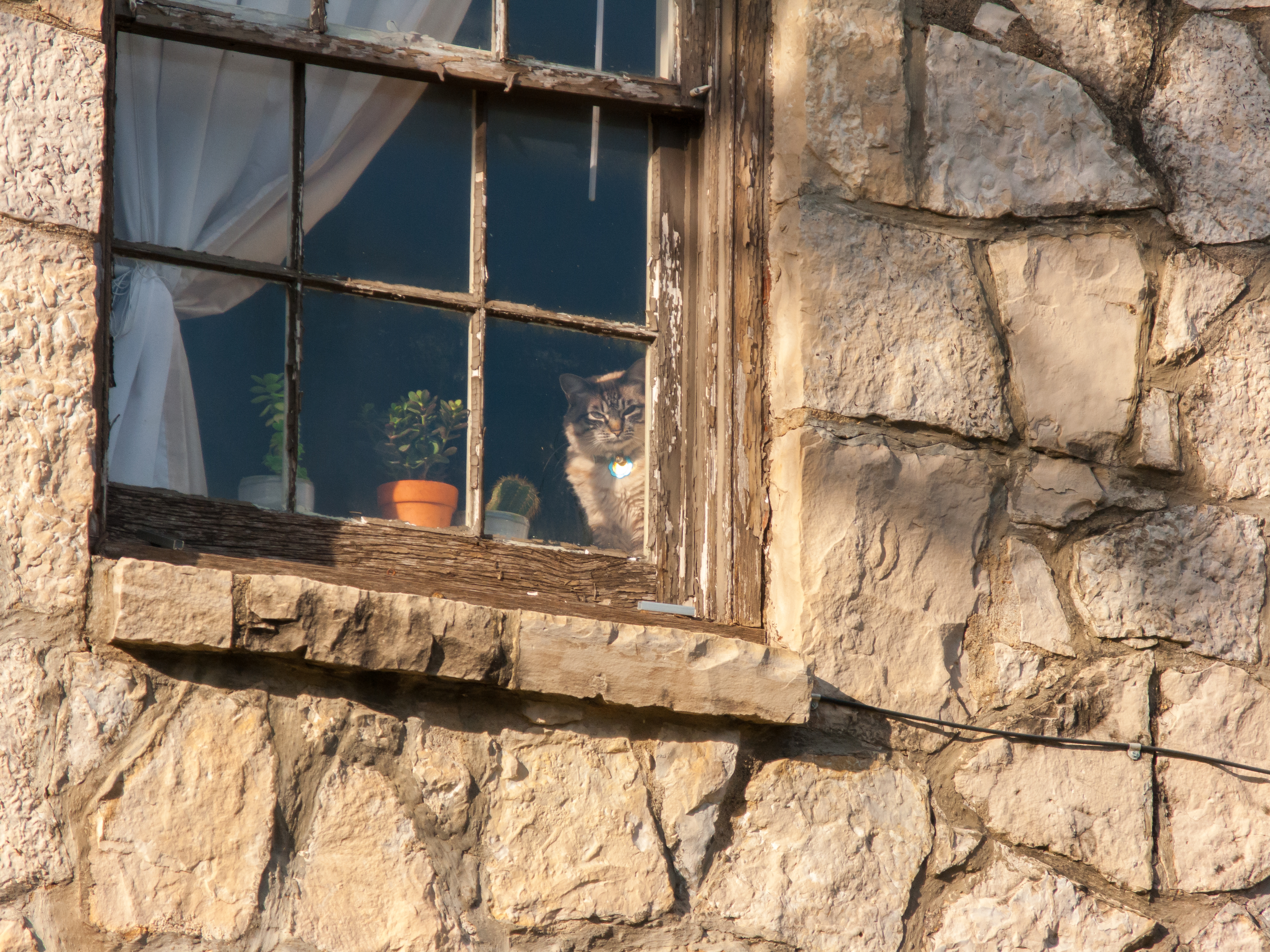
Cat in the window along Dixon Street in Fayetteville Arkansas
Taken with a Canon G10, iso 100, 44.4mm, 1/400 of second. During one my trips to visit my older daughter while she was enrolled at the University of Arkansas, Fayetteville I was able to catch this shot. We were walking along the Dixon street which has a lot of great character and I glanced up and found this cat starring back at me. I was only carrying my Canon G10, but it had enough zoom range to get the shot I wanted. The G10 is a good all round camera and I feel that it’s still one of the best of the Canon G series. I cropped into the shot to get the effect I wanted, the G10 had enough pixels that I didn’t lose too mnay details.
07/27/12 Featured Arkansas Photography–Sunrise throught the trees
- At July 27, 2012
- By paul
- In Featured Arkansas Photography
- 0
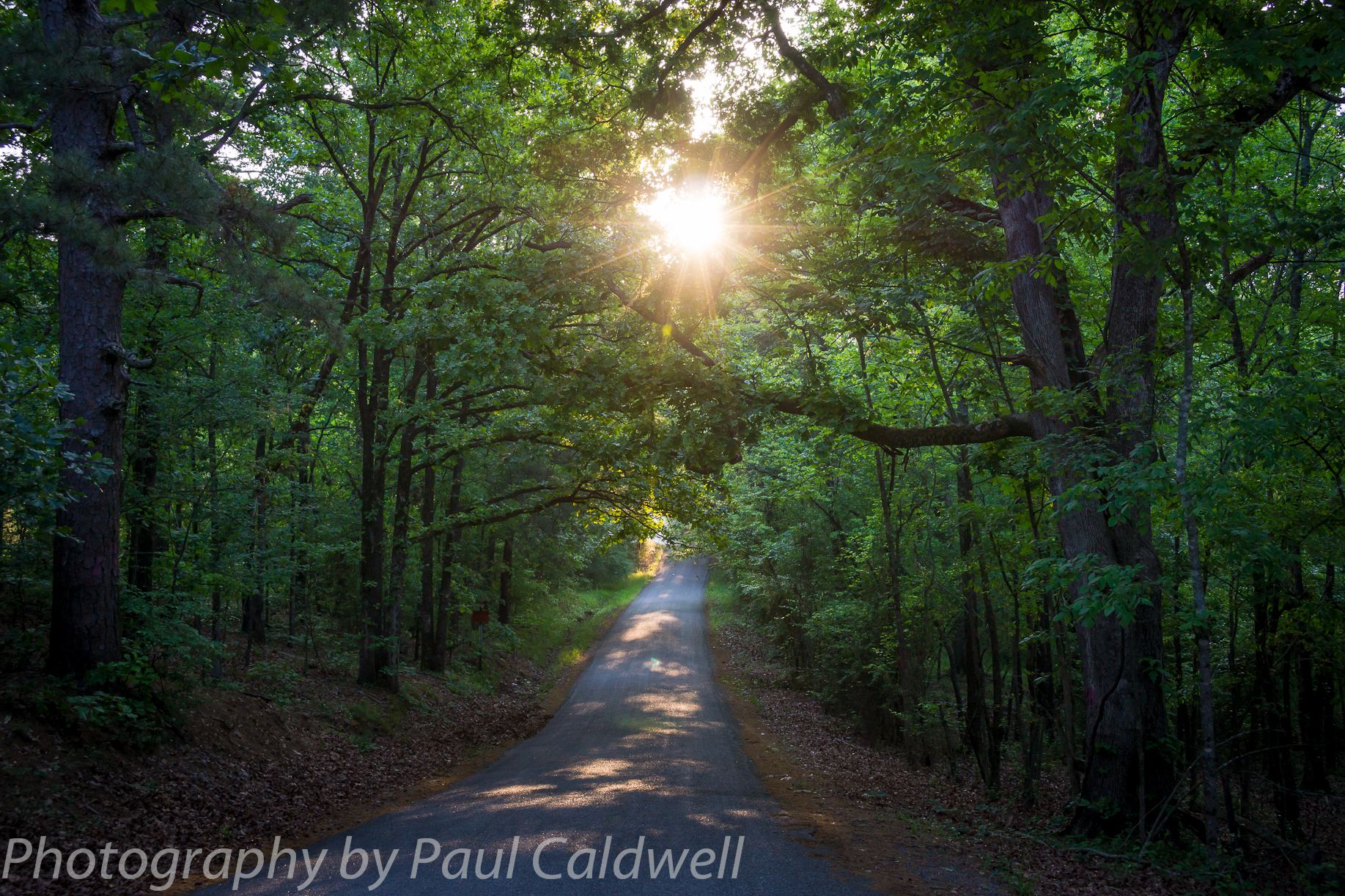
Sunrise through the trees in Pulaski County, Arkansas
Click on the photograph for a larger image.
Taken with a Sony Nex-7, Sony 18-200 Zoom lens @ 30mm, F5.6 1/125th of a sec, iso 400. I like to drive along the rural roads in Arkansas to look for scenes like this one which was taken in western Pulaski county, Arkansas. This image was taken in late April before the effects of the drought began to really show in the state. This is a typical rural county road, which is only about 1 lane wide. The state of Arkansas has thousands of miles of roads like this and such roads are a great place to head out and look for a spot to photograph that is off the beaten path. I used a tripod to take this shot and it’s not a HDR composite which I would normally do in a scene like this. The Sony Nex-7 was able to handle the exposure range fine at iso 400 with a single exposure.
 From the Blog
- Errors with High Resolution Mode, Panasonic LUMIX S1RII July 4, 2025
- 05/08/25 Capture One, big announcement, at least for portrait photographers May 8, 2025
- 05/03/25 Trump’s Tariffs finally start to hit Photography Equipment. May 3, 2025
- Firmware 4.1.0 for X2D? April 21, 2025
- 04/18/25–Looks like Trump’s Tariffs are much ado about NOTHING in regard to photography equipment. April 18, 2025
- 04/09/25 Arkansas Sets new standard for Scientific Ignorance with new law for Ivermectin April 4, 2025