06/13/20 Sunset over Western Little Rock and the Big Dam Bridge
- At June 14, 2020
- By paul
- In Featured Arkansas Photography
 0
0
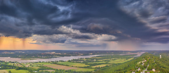
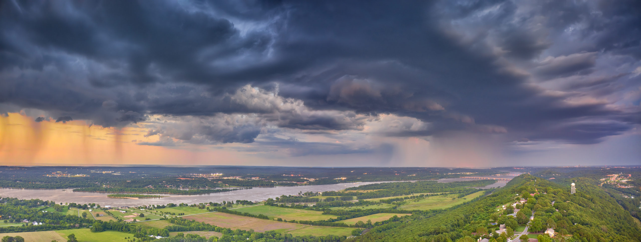
Stormy skies over Little Rock, and the Big Dam Bridge
Taken with a DJI Mavic 2 Pro. For this shot I was forced to use multiple AEB bursts of 5 shots each, knowing that I would be throwing most of them out. However it’s the only way to get a a full reach of dynamic range from this drone as DJI really did a poor job on the raw capture process. But that’s another story in itself.
This was one of those wonderful thunderstorms that just rolled in quickly after the sun had dropped below the horizon. I started taking the shots right at around 8:00 pm and was able to shoot well towards 8:2o. This shot was one a rare shot as I was able to catch the full thunderstorm to the right of the shot and then the clear evening sky to the left. I used Capture One software to convert the raw files. I took 10 shots for the bottom portion to finally get a single file that was not too noisy. The sky was much easier to capture with just the normal 5 exposures. Once I had the images completed in Capture One, I opened them as tifs in Photoshop and layered the sky over the bottom of the image, doing this for the right and left half of the shot. Then I used Photoshop’s panoramic software to combine the final two images. Photoshop will do OK most of the time as long as you don’t have a pure blue sky or any other type of solid sky. The longest exposure was 1.6 seconds, which I feel is about the longest you can go with a drone in most conditions.
Paul Caldwell
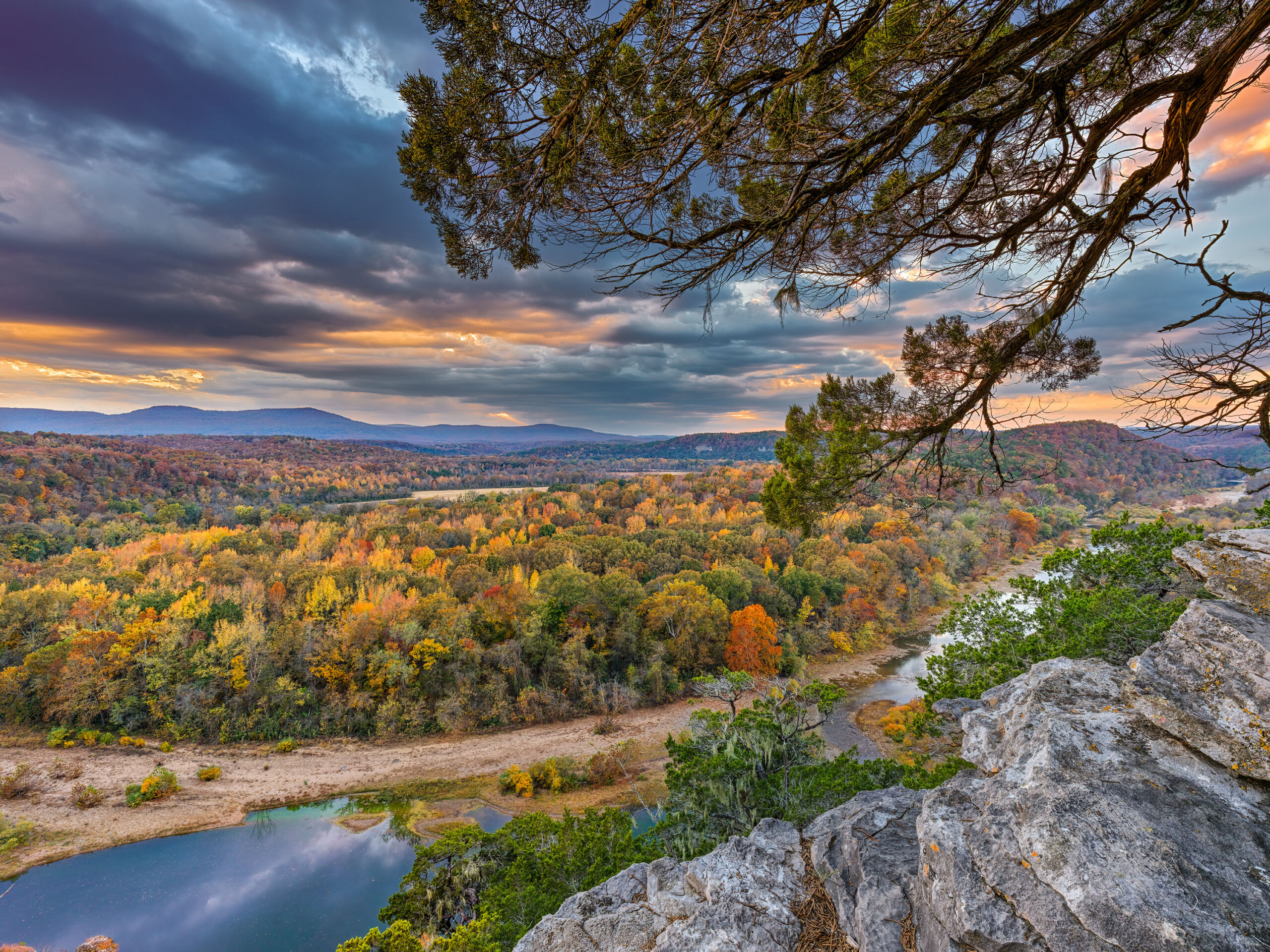
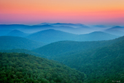
06/13/20 A sunset with a stormy sky over Pinnacle Mountain
- At June 14, 2020
- By paul
- In Featured Arkansas Photography
- 0
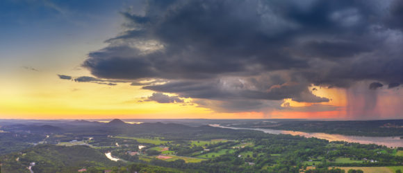

A panorama taken with a DJI Mavic Pro 2
Taken with a DJI Mavic 2 Pro. For this shot I was forced to use multiple AEB bursts of 5 shots each, knowing that I would be throwing most of them out. However it’s the only way to get a a full reach of dynamic range from this drone as DJI really did a poor job on the raw capture process. But that’s another story in itself.
This was one of those wonderful thunderstorms that just rolled in quickly after the sun had dropped below the horizon. I started taking the shots right at around 8:00 pm and was able to shoot well towards 8:2o. This shot was one a rare shot as I was able to catch the full thunderstorm to the right of the shot and then the clear evening sky to the left. I used Capture One software to convert the raw files. I took 10 shots for the bottom portion to finally get a single file that was not too noisy. The sky was much easier to capture with just the normal 5 exposures. Once I had the images completed in Capture One, I opened them as tifs in Photoshop and layered the sky over the bottom of the image, doing this for the right and left half of the shot. Then I used Photoshop’s panoramic software to combine the final two images. Photoshop will do OK most of the time as long as you don’t have a pure blue sky or any other type of solid sky. The longest exposure was 1.6 seconds, which I feel is about the longest you can go with a drone in most conditions.
Paul Caldwell
 From the Blog
- Errors with High Resolution Mode, Panasonic LUMIX S1RII July 4, 2025
- 05/08/25 Capture One, big announcement, at least for portrait photographers May 8, 2025
- 05/03/25 Trump’s Tariffs finally start to hit Photography Equipment. May 3, 2025
- Firmware 4.1.0 for X2D? April 21, 2025
- 04/18/25–Looks like Trump’s Tariffs are much ado about NOTHING in regard to photography equipment. April 18, 2025
- 04/09/25 Arkansas Sets new standard for Scientific Ignorance with new law for Ivermectin April 4, 2025